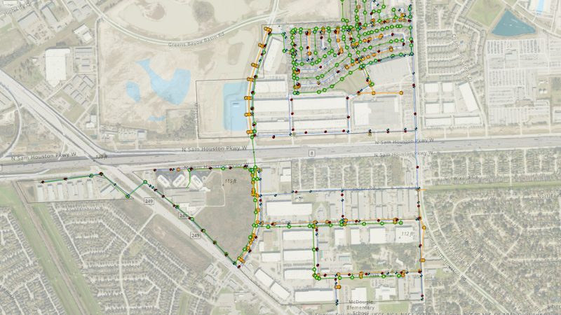
Northwest Harris County MUD No. 24 (the District) is approximately 400 acres servicing more than 400 connections. The District envisioned a GIS that would enhance operations for utility management with a location-based system of record. The project encompassed Web GIS managed services, coupled with precise field locating of above-ground assets and managed data management services.
Our team successfully hosted, configured, and implemented OEG’s specialized Web GIS solution tailored to the unique requirements of the District. This platform now serves as a centralized hub for utility management, offering secure, uninterrupted hosting and streamlined operational workflows. We deployed skilled teams equipped with high-precision GPS/GNSS receivers to create a precise inventory of assets spanning water infrastructure, stormwater facilities, and sewer systems. The acquired field data, including digital plans and digitized flow lines based on plan documents, has been seamlessly integrated into a unified and geospatially accurate GIS database. This integrated database is a valuable asset for centralized management and future planning within the District. To ensure optimal utilization of the Web GIS platform, our team conducted tailored training sessions for the District and its Operators.
Northwest Harris County No. 24Odyssey Engineering Group2024-05-28T22:13:45-05:00
![]()