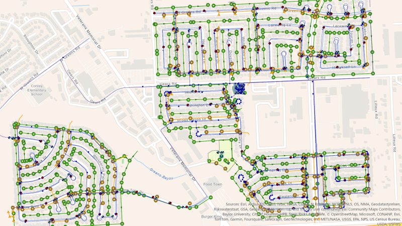
Harris County MUD No. 33 (the District) is approximately 500 acres servicing over 1,700 connections. The District envisioned a GIS that would enhance operations for utility management with a location-based system of record. The project encompassed Web GIS managed services, coupled with precise field locating of above-ground assets and managed data management services.
We deployed skilled teams equipped with high-precision GPS/GNSS receivers to create a comprehensive, precise inventory of assets spanning water infrastructure, stormwater facilities, and sewer systems. The acquired field data, including digital plans and digitized flow lines based on plan documents, has been seamlessly integrated into Odyssey’s specialized Web GIS solution tailored to the unique requirements of the District. This platform now serves as a centralized hub for utility management, offering secure, uninterrupted hosting and streamlined operational workflows.
Harris County MUD No. 33Odyssey Engineering Group2024-05-28T22:12:27-05:00